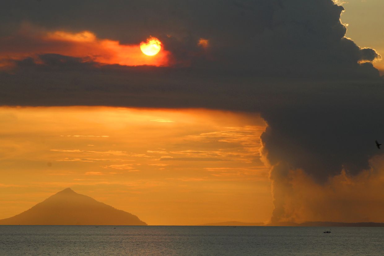
Indonesia's Mount Anak Krakatau unleashed another eruption on Tuesday morning, July 7, as the volcano continues its alarming escalation in activity across the Sunda Strait. The Geological Agency of the Energy and Mineral Resources recorded the event at 8:21 a.m., with seismic instruments detecting a maximum amplitude of 11 millimetres during the roughly 15-second eruption. Observers documented a dense gray ash column rising 100 metres from the crater before drifting toward the north-west, adding to mounting concerns about the volcano's unpredictable behaviour in recent weeks.
The steady uptick in volcanic activity at Mount Anak Krakatau represents a dramatic shift from months of relative calm. Beginning on June 10, the volcano emerged from an extended dormant phase and has not since looked back. The pace of seismic disturbances escalated sharply between June 18 and 19, when tremors and low-frequency earthquakes averaged more than 50 daily occurrences. This frequency intensified further through early July, with average daily events reaching 97 by July 2—a seventeen-fold increase in seismic energy release compared to the mid-June baseline. The volcano has now completed five eruptions since its first event on Thursday, signalling a potentially dangerous trend for the region.
Indonesia's authorities responded to the mounting threat by elevating Mount Anak Krakatau to Level III (Watch) status on Friday, marking the second-highest alert tier in the country's four-level volcanic classification system. This decision reflected serious concern about the volcano's trajectory and the rising risk to nearby communities and maritime activity. Simultaneously, officials established a three-kilometre exclusion perimeter around the crater, effectively closing off substantial portions of the Sunda Strait to civilian traffic and recreational activities. Andi Suwardi, head of the Mount Anak Krakatau Observation Post based in South Lampung, confirmed that the alert status would remain at this elevated level pending further developments, noting that eruptions continue with fluctuating intensity but without yet justifying a move to the highest alert classification.
Despite official warnings and access restrictions, economic pressure continues to drive risky behaviour among local fishermen and tourism operators. Communities dependent on income from fishing and maritime tourism face genuine hardship as volcanic activity curtails their livelihoods. Some have chosen to venture into restricted waters, attempting to avoid detection by monitoring authorities in hopes of securing catches or ferrying tourists. South Lampung Regent Radityo Egi Pratama appealed directly to these groups, acknowledging the economic squeeze while urging them to prioritise personal safety over immediate income. The regent recognised that local economies have already suffered from the heightened volcanic activity, yet stressed that no amount of short-term financial gain justifies exposure to potential catastrophic hazards.
Mount Anak Krakatau's volatile behaviour cannot be divorced from its dramatic geological heritage. The volcano emerged from beneath the ocean surface in 1927, gradually building itself within the caldera left by the epochal 1883 eruption of its parent volcano, Mount Krakatau. That historic cataclysm remains one of humanity's deadliest recorded volcanic disasters, claiming approximately 36,000 lives across the region through direct explosions, pyroclastic flows, and tsunami waves. The eruption's violence proved so great that it ejected enormous quantities of ash and aerosols into the upper atmosphere, altering global climate patterns and darkening skies across continents for months. Understanding this ancestral context helps explain why Indonesian authorities approach Mount Anak Krakatau's activity with particular caution—the region possesses bitter historical memory of what these waters can unleash.
The volcano demonstrated its capacity for destruction more recently on December 22, 2018, when a partial collapse of its flank generated a destructive tsunami that swept across the Sunda Strait. The waves battered coastal areas of southern Sumatra and western Banten with devastating effect, killing at least 429 people and injuring more than 7,200 others. That event served as a sobering reminder that Mount Anak Krakatau poses not merely an ash and lava hazard but also potential tsunami danger to densely populated shorelines. The 2018 disaster illustrated how submarine volcanic failures can rapidly translate into widespread human tragedy, a lesson that informs current monitoring protocols and the precautionary principle guiding official responses.
Monitoring teams stationed at the Mount Anak Krakatau Observation Post maintain continuous 24-hour surveillance, tracking multiple indicators of volcanic stress and change. Seismic data remains the primary window into the volcano's internal behaviour, with frequency and amplitude of earthquakes offering crucial insight into magma movement and pressure accumulation. The observation of ash plume height, composition, and dispersal patterns provides additional diagnostic information about eruption style and potential hazard zones. These multi-parameter assessments allow Indonesian officials to distinguish between concerning escalations that warrant alert-level changes and routine fluctuations consistent with sustained but stable volcanic unrest. The methodology reflects decades of hard-won expertise born from managing one of the world's most seismically and volcanically active regions.
For maritime industries and regional commerce, the restrictions around Mount Anak Krakatau create tangible operational challenges. Fishing grounds that historically supported thousands of livelihoods now lie off-limits. Tourism operators who previously conducted lucrative boat tours around the volcanic island face revenue loss and cancellations. The three-kilometre exclusion zone effectively removes a substantial portion of the Sunda Strait from productive use, creating economic ripples that extend beyond the immediate observation area. Ports and coastal communities dependent on maritime trade and tourism must adapt to uncertainty regarding how long restrictions will remain in place and whether the alert status will escalate further, potentially triggering broader closure of waterways.
The broader regional context amplifies attention to Mount Anak Krakatau's behaviour. Southeast Asia sits atop the Pacific Ring of Fire, where Indonesia itself hosts more active volcanoes than any other nation on Earth. The region's exposure to seismic and volcanic hazards is not exceptional but rather routine. However, the density of human settlement around Indonesian volcanoes—combined with the region's economic dependence on fishing, tourism, and maritime commerce—means that volcanic crises carry particularly acute social and economic consequences. The current activity at Mount Anak Krakatau serves as a fresh reminder of the region's geophysical volatility and the constant balancing act between economic necessity and geological risk that characterises life in this part of the world.
As monitoring continues and official assessments evolve, the situation remains fluid. The volcano's trajectory over the coming days and weeks will determine whether current alert levels prove sufficient or whether further escalation becomes necessary. Indonesian authorities face the dual challenge of managing legitimate public anxiety without triggering economic panic, while simultaneously ensuring that communities understand genuine risks. The exclusion zone and alert system represent attempts to strike that balance—restrictive enough to prevent loss of life from sudden eruption or tsunami, yet not so extreme as to utterly paralyse local economies. Whether this calibration proves adequate depends ultimately on Mount Anak Krakatau's next moves.

