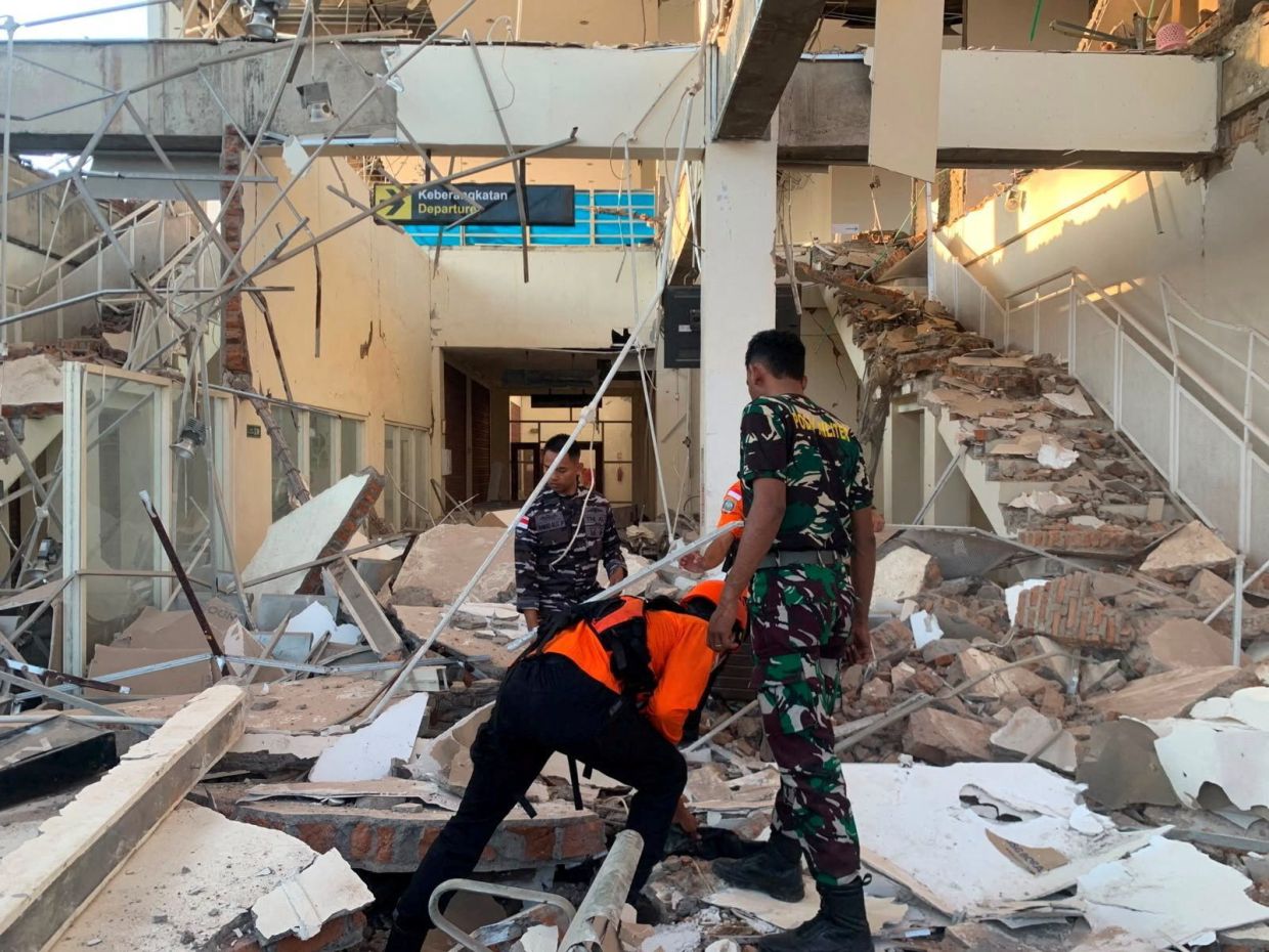
A magnitude 7.7 earthquake struck off the coast of Indonesia's Flores region in the predawn hours of Saturday, August 15, unleashing destruction across communities in one of the world's most seismically active zones. The tremor, which originated 68 kilometres north-northwest of the city of Ende in East Nusa Tenggara province, was centred at a shallow depth of just 10 kilometres beneath the ocean floor. The initial violent shaking, which struck at 5:58 a.m. local time according to the U.S. Geological Survey, was rapidly followed by multiple aftershocks that kept residents in a state of heightened alert throughout the morning hours.
The immediate human toll reflected the quake's destructive power. Early reports from the Maumere Search and Rescue Agency confirmed at least two deaths, with two additional people sustaining injuries as the earthquake reduced numerous buildings to rubble across the affected region. The structural damage proved extensive, with eyewitness accounts describing widespread collapse of both residential dwellings and public infrastructure. The vulnerability of local construction to seismic forces became apparent as buildings throughout Flores crumbled under the intense ground motion, a pattern all too familiar in this tectonically unstable corner of Southeast Asia.
The quake's impact on healthcare delivery illustrated the cascading effects of such natural disasters. Television coverage captured scenes of hospital staff evacuating patients from multiple medical facilities as a precautionary measure, creating scenes of organised chaos as personnel transported beds, intravenous stands, and oxygen equipment to open-air areas. Medical teams hastily established makeshift treatment zones outdoors, adapting quickly to emergency protocols designed for situations exactly like this one. This rapid improvisation, born from experience with frequent seismic events, underscored both the preparedness and the vulnerability of regional healthcare infrastructure.
Yohanna Embu, a Sikka resident within East Nusa Tenggara province, provided on-the-ground perspective on the damage. She described how terrified residents bolted toward elevated terrain as buildings around them sustained significant structural harm. Among the demolished structures was the waiting room at Maumere's port terminal, a key piece of regional transportation infrastructure now rendered unusable. Her account captured the sudden fear that grips communities accustomed to earthquakes but never truly prepared for their devastating consequences.
The earthquake's impact extended to religious institutions, where the spiritual rhythm of the community was violently interrupted. Students and nuns attending morning Mass at St. Peter Major Seminary, locally known as Ritapiret Seminary in predominantly Catholic Flores, fled in panic as the roof of their assembly hall gave way above their heads. The Rev. Guidelbertus Tanga, serving as rector of the seminary, reported that at least one priest suffered a fractured leg after jumping from a second-storey window during the quake's violent shaking. Such incidents highlight how sudden seismic events can cause injuries beyond those resulting from structural collapse itself.
Initial response from Indonesia's emergency management systems demonstrated both their strengths and limitations. The Meteorology, Climatology and Geophysics Agency quickly issued tsunami warnings across multiple provinces including parts of East Nusa Tenggara, West Nusa Tenggara, South Sulawesi, and Southeast Sulawesi. Coastal residents received urgent directives to evacuate beaches, avoid riverbanks, and seek high ground immediately. However, within a relatively short timeframe, authorities withdrew the tsunami alert after continuous monitoring indicated that sea-level changes remained below dangerous thresholds. This decision, though ultimately correct, nevertheless highlighted the critical minutes of uncertainty following such events when coastal populations cannot be certain whether greater dangers loom.
Indonesia's precarious geographical position makes such earthquakes an ongoing reality for its inhabitants. The sprawling archipelago of more than 17,000 islands sits directly atop the Pacific Ring of Fire, a chain of volcanoes and fault lines encircling the Pacific Basin. This geological circumstance condemns Indonesia to a perpetual state of seismic vulnerability, where major earthquakes strike with troubling regularity and often with devastating consequences. The region's tectonic complexity means that destructive quakes are not aberrations but rather inevitable features of the natural environment.
The historical record underscores the region's terrifying seismic potential. In December 1992, a catastrophic earthquake and subsequent tsunami ravaged Flores itself, claiming approximately 2,500 lives across the southeastern island. That disaster, which struck the same general area now affected by this latest quake, served as a grim reminder of how rapidly geological forces can transform daily life into tragedy. The three-decade interval between that disaster and this week's tremor might suggest a lull in activity, but geologically speaking, such timeframes are negligible. The Ring of Fire's relentless energy accumulation ensures that another major rupture remains not a question of if, but when.
For Malaysian and broader Southeast Asian observers, this earthquake carries multiple implications. The region's interconnected economies mean that infrastructure damage in Indonesia can ripple across maritime trade routes vital to regional commerce. More immediately, the incident reinforces how tectonic realities shape the lived experience of millions across the Indonesian archipelago, forcing constant adaptation to extraordinary natural hazards. The resilience demonstrated by communities like those in Flores, repeatedly confronting and recovering from seismic disasters, reflects both human determination and the sobering reality that some natural forces remain beyond effective mitigation despite our technological advances.

