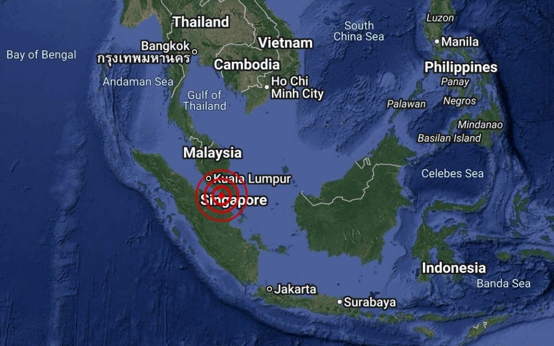
A minor earthquake measuring 3.1 in magnitude struck the waters southwest of Batu Pahat in Johor on August 25, according to the Malaysian Meteorological Department. The tremor occurred at 4.12 pm local time, with its epicentre positioned at coordinates 1.7 degrees north and 102.8 degrees east, placing it approximately 18 kilometres south-west of the coastal town.
The National Weather and Earthquake Operations Centre, which forms part of MetMalaysia, issued an immediate statement confirming the seismic event and its location. Earthquakes of this magnitude are classified as weak and typically cause minimal to no damage to structures or infrastructure. The offshore location of this particular event further reduced any potential impact on populated areas, as the tremor occurred in open water rather than near densely inhabited regions.
MetMalaysia moved swiftly to reassure the public and maritime operators by explicitly stating that there was no tsunami threat to Malaysia resulting from this seismic activity. This assessment is consistent with international seismic standards, which generally indicate that earthquakes below 5.0 magnitude pose minimal risk of generating dangerous tsunami waves. The rapid communication from authorities helps prevent unnecessary panic and ensures that maritime traffic and coastal communities can continue normal operations without concern.
The Johor coastline, particularly the Batu Pahat area, sits in a relatively stable seismic zone compared to other parts of Malaysia. Tremors in this region are not uncommon but typically remain minor in magnitude. The Strait of Malacca and the surrounding offshore waters occasionally experience seismic activity due to tectonic movements in the broader Southeast Asian region, though major earthquakes are relatively rare. This particular event aligns with the region's typical seismic pattern of low to moderate intensity disturbances.
For Malaysian residents and businesses in the Johor region, particularly those in Batu Pahat and surrounding areas, the earthquake would have been barely perceptible or not noticeable at all. The distance from the epicentre and the weak magnitude meant that ground shaking was minimal. Most buildings and infrastructure in the area would have experienced no movement detectable to occupants, and certainly no structural stress or damage. This contrasts sharply with more significant seismic events that can cause considerable disruption and destruction.
The role of MetMalaysia in monitoring and reporting seismic activity represents an important component of Malaysia's disaster preparedness framework. The department maintains a network of seismic monitoring stations throughout the country and continuously tracks earthquake activity in the region. By providing prompt, accurate information about seismic events, MetMalaysia enables emergency services, maritime authorities, and the general public to respond appropriately and maintain confidence in the country's monitoring capabilities.
From a maritime perspective, the Batu Pahat waters are moderately trafficked shipping lanes connecting major ports in Johor and the broader Strait of Malacca region. Vessels operating in these waters during the earthquake would have experienced no significant impact from the tremor. Shipping companies and port authorities rely on timely seismic and tsunami information to ensure safe operations, and MetMalaysia's quick assessment would have provided necessary reassurance to maritime operators in the area.
The August 25 event serves as a reminder of the ongoing geological activity in Southeast Asia, even though Malaysia itself experiences relatively infrequent seismic events compared to neighbouring countries like Indonesia and the Philippines. The region's complex tectonic setting means that occasional earthquakes are inevitable, but Malaysia's location on relatively stable continental crust generally means these events remain minor. Continued monitoring and public communication about seismic activity help maintain public awareness while preventing unnecessary alarm.
Looking forward, MetMalaysia's ongoing surveillance of seismic patterns contributes valuable data to regional earthquake monitoring networks. Understanding long-term seismic trends helps researchers and emergency management officials better prepare for potential future events and refine risk assessments for critical infrastructure. For residents of Johor and other parts of Malaysia, the regular communication of seismic information builds public confidence that the country's authorities are vigilant and capable of managing natural hazards effectively.

