Chinese authorities have determined that a glacier rupture high in the Himalayan mountains of Nepal directly triggered the devastating mudslide that destroyed Gyirong Port in southwest Xizang Autonomous Region on August 26. The cross-border disaster, which has claimed at least 16 lives and left hundreds unaccounted for, represents a stark reminder of how climate-driven changes in mountain environments can have immediate and severe consequences across international boundaries in the Asian highlands.
According to findings presented by the regional government's information office on Sunday, the catastrophe began when a glacier situated on the southern slope of Mount Langtang Lirung fractured at approximately 5,200 metres elevation. The fracturing of this glacier initiated a violent ice-rock avalanche that descended with tremendous force down the mountainside. Scientists from the Institute of Mountain Hazards and Environment, operating under the Chinese Academy of Sciences, conducted the analysis that definitively linked the Nepalese glacier failure to the subsequent debris flow.
The avalanche's destructive energy intensified as it descended through successive elevation bands. Upon reaching an altitude near 4,000 metres, the ice and rock mass had transformed into a massive debris flow as it scraped and scoured the exposed mountainside, accumulating material and velocity. This developing torrent of mixed ice, rock, and earth material then maintained its momentum across approximately 22 kilometres of terrain before finally reaching Gyirong Port, situated at roughly 1,800 metres above sea level.
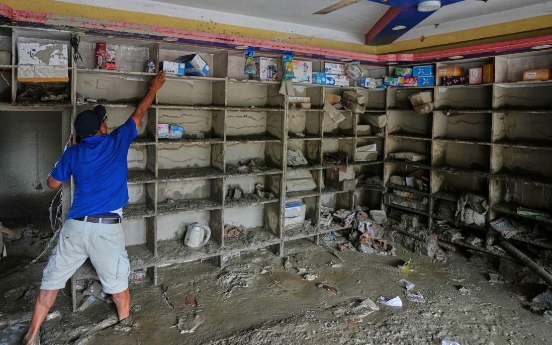
The physical devastation wrought by this natural disaster was both extensive and concentrated. The mudslide flattened an area spanning approximately 0.7 square kilometres in and around Gyirong Port. Within this affected zone, 27 buildings and associated infrastructure were destroyed or severely damaged, effectively eliminating structures that had existed in this border community. The scale of physical destruction underscores the immense energy released when mountain glaciers fail catastrophically.
The Institute of Mountain Hazards and Environment employed multiple investigative methodologies to establish the Nepalese glacier as the source. Researchers analysed remote-sensing monitoring data captured by satellites and aerial systems, compared this information against field-transmitted data collected in real time, and conducted comprehensive on-site surveys and investigations at both the origin point and the impact zone. This multi-layered analytical approach provided the scientific certainty necessary for authorities to confidently identify the transnational nature of the disaster.
As of Saturday evening, the confirmed death toll had reached 16 persons, while 546 individuals remained categorised as missing. These figures, announced Sunday morning by the regional government, reflect the profound human toll of the August 26 disaster. The large number of missing persons suggests that some victims may be buried beneath debris flows or may have been swept downstream by the initial surge of material.
This incident carries particular significance for mountainous regions throughout Asia where similar geological and climatic conditions exist. Nepal and Chinese Xizang share extensive high-altitude terrain featuring numerous glaciers that have experienced accelerating retreat and instability in recent decades. Climate warming has altered the mechanical properties of glacial ice, making fractures and avalanches increasingly common. The Gyirong Port disaster demonstrates that these changes pose hazards not only to populations in the immediate vicinity of glaciers but also to communities located far downstream in river valleys.
For Malaysia and other Southeast Asian nations, this event underscores the interconnected nature of environmental challenges in Asia's mountain systems. Rivers originating in the Himalayas flow through multiple countries and support hundreds of millions of people. Disasters triggered by glacier instability in Nepal can directly affect populations in China, and similar cascading effects from mountainous regions can impact communities across the region. Understanding these transnational hazard chains has become essential for effective regional disaster preparedness and response coordination.
The role of Chinese scientific institutions in rapidly analysing and explaining this disaster highlights the importance of investing in mountain hazard research capacity. The Institute of Mountain Hazards and Environment's swift deployment and detailed assessment provided authorities with actionable intelligence while also contributing to broader scientific understanding of how glacial systems behave under changing conditions. Such institutional capabilities prove invaluable for issuing early warnings and understanding emerging risks in mountainous regions.
Climate change emerges as an underlying factor shaping the frequency and intensity of such events. As global temperatures rise, Himalayan glaciers continue contracting, exposing rock faces and destabilising accumulated ice masses. The physical properties of weakened ice make sudden collapses more probable. Scientists have documented accelerating glacier retreat across the Hindu Kush-Himalayan region, suggesting that avalanche-triggered mudslides may become more common in coming decades unless mitigation strategies are implemented.
The cross-border dimension of this disaster also raises questions about international cooperation frameworks for managing shared mountain hazards. While Nepal and China have diplomatic relationships and some existing agreements on water resources and environmental matters, the Gyirong Port incident illustrates gaps in real-time hazard communication and coordinated preparedness. Establishing early warning systems that span national boundaries and share data on glacier stability could potentially save lives in future incidents by providing downstream communities with critical advance notice of debris flow events.
Recovery and reconstruction efforts in Gyirong Port will likely focus initially on search and rescue operations, followed by clearing debris and rebuilding destroyed infrastructure. The long-term challenge involves determining how communities in such high-risk zones can coexist with naturally hazardous mountain environments undergoing rapid change. Some experts suggest that certain locations may become increasingly untenable for habitation as glacial hazards intensify, requiring difficult decisions about relocation and land-use planning in vulnerable border regions.

