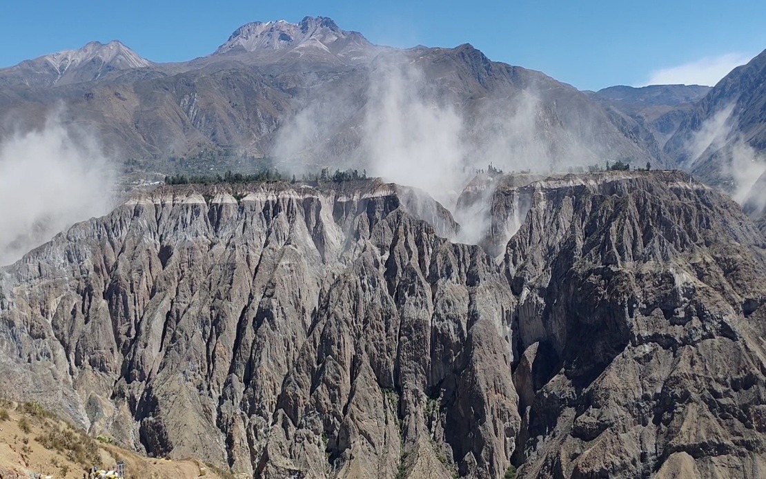
A significant 6.7 magnitude earthquake jolted southern Peru on Thursday afternoon, sending tremors across multiple regions and triggering emergency alerts among authorities and the public alike, according to reports from the US Geological Survey (USGS). The seismic event underscored the ongoing vulnerability of the South American nation to powerful natural disasters, a reality that has prompted regional disaster management agencies to renew calls for heightened preparedness among residents.
The Geophysical Institute of Peru (IGP) assessed the tremor at magnitude 7.2, with seismic activity occurring at approximately 1 pm local time at an intermediate depth of 108 kilometres beneath the earth's surface. The National Seismological Centre (CENSIS), a division of the IGP responsible for monitoring seismic events across the nation, pinpointed the epicentre roughly 35 kilometres north of Coracora, a municipality situated within Parinacochas province in the Ayacucho department of southern Peru.
Despite the formidable magnitude of the earthquake, Peruvian disaster risk authorities and emergency response agencies confirmed that the initial assessment revealed no reported deaths or substantial structural damage to buildings and infrastructure. This outcome, while fortunate, reflects the complex relationship between earthquake magnitude and ground-level impact—a distinction that geophysicists emphasize is crucial for public understanding of seismic hazards.
Geophysicists attribute the limited destructive consequences to a critical factor: the depth at which the earthquake originated. The 108-kilometre depth allowed the seismic energy to dissipate significantly before reaching the surface, substantially reducing the shaking intensity experienced by communities above the epicentre. Seismic intensity experts calculated a Mercalli intensity rating of between III and IV—categorized as light to moderate shaking—in the immediate vicinity of the epicentre. This relatively moderate intensity rating, despite the high magnitude, illustrates why earthquake professionals distinguish between magnitude, which measures energy release, and intensity, which measures actual ground effects experienced by people.
The earthquake's effects rippled across southern and central Peru, with residents in numerous municipalities reporting noticeable ground motion. Most notably, the tremor was felt distinctly in Lima, the capital city situated hundreds of kilometres away on Peru's central coast. The wide geographic distribution of felt reports reflects how intermediate-depth earthquakes can transmit seismic energy across vast distances, affecting population centres far removed from the epicentre.
Thursday's earthquake represents part of a broader pattern of elevated seismic activity that has characterized Peru's northern and southern regions in recent months, according to monitoring data from the IGP. This clustering of seismic events has prompted scientific agencies to maintain heightened surveillance of fault zones and active geological regions throughout the country. The persistence of seismic activity serves as a persistent reminder of Peru's location within one of the planet's most geologically dynamic zones.
Responding to the renewed seismic activity, the IGP has issued public advisories urging Peruvians to take concrete preparedness measures. The institute recommends that households review and practice evacuation protocols specific to their locations and building types, conduct regular inspections of structural integrity, and maintain readily accessible emergency supply kits containing water, first aid materials, and essential documents. These measures align with international best practices for earthquake preparedness in seismically active regions.
Peru's susceptibility to powerful earthquakes stems from its position along the Pacific Ring of Fire, the renowned arc of intense geological activity that encircles the Pacific Ocean. This geographic positioning places Peru at the convergence of major tectonic plates, creating conditions for frequent seismic activity ranging from minor tremors to devastating earthquakes. The subduction zone where the Nazca Plate descends beneath the South American Plate generates the majority of Peru's significant seismic events.
The historical record of Peruvian earthquakes demonstrates the potential for catastrophic consequences when major seismic events strike population centres. The 2007 Ica earthquake, which registered 7.9 magnitude, remains one of the most devastating seismic disasters in recent Peruvian history. That earthquake, which primarily affected the Ica region in southern Peru, resulted in nearly 600 deaths and caused extensive infrastructure damage across multiple provinces. The 2007 event established a sobering baseline for understanding the destructive potential of major earthquakes in Peru.
For regional observers, including those in Southeast Asia where earthquake hazards are similarly prevalent, Peru's experience offers instructive lessons about the importance of robust early warning systems, building code enforcement, and community preparedness programmes. Several Southeast Asian nations, particularly Indonesia and the Philippines, face comparable seismic risks due to their Ring of Fire locations. The comparative analysis of how different nations manage earthquake hazards—from monitoring systems to public communication strategies—provides valuable benchmarks for regional disaster risk reduction efforts.
The Thursday earthquake also highlights technological advances in seismic monitoring that enable rapid assessment and response. Modern seismic networks, such as Peru's comprehensive monitoring infrastructure, can now distinguish between earthquake magnitude and intensity within minutes of an event, allowing authorities to quickly communicate realistic risk assessments to the public. This capability reduces panic and enables more targeted emergency response deployment based on actual rather than theoretical damage patterns.
Looking forward, Peru's disaster management authorities face the ongoing challenge of balancing preparedness efforts with public communication that neither minimizes genuine risks nor generates excessive alarm. The IGP's measured response to Thursday's earthquake—acknowledging the significant magnitude while clarifying why damage remained limited—exemplifies this challenging communication task. As seismic activity continues in Peru's various regions, sustained investment in monitoring infrastructure, public education, and building resilience will remain essential components of the nation's disaster risk reduction strategy.

