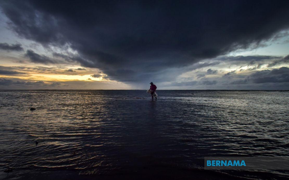
A widespread weather alert covering most of Malaysia remained in effect on June 20 as the Malaysian Meteorological Department warned of thunderstorms, torrential downpours and gusty winds expected to batter the nation until early evening. The alert encompasses the entirety of Peninsular Malaysia alongside significant portions of Sabah, Sarawak and the Federal Territory of Labuan, potentially affecting millions of residents and disrupting daily activities across the archipelago.
The northern states face particularly intense conditions. The entire regions of Perlis and Penang fall under the alert zone, while in Kedah seven districts have been identified as vulnerable including the tourist destinations of Langkawi alongside Kubang Pasu, Padang Terap, Sik, Baling, Kulim and Bandar Baharu. These areas, which typically experience tropical weather patterns, were being advised to prepare for severe atmospheric conditions that could impact transport networks and public services.
Perak, one of the largest states by area, has eleven districts positioned within the warning boundary. The affected zones stretch from the west coast municipalities of Kerian, Larut, Matang and Selama through to the interior highland regions encompassing Hulu Perak, Kuala Kangsar and Manjung. The inclusion of Kinta and the administrative centre of Ipoh's surroundings underscores the extensive geographic reach of the forecasted disturbance across the state's diverse terrain ranging from coastal plains to elevated plateau regions.
Central Peninsular Malaysia has also been placed on alert status. Cameron Highlands, the verdant hill station renowned for tea cultivation, alongside Raub, Bentong and Rompin in Pahang face potential disruption from the incoming weather system. In Selangor, three strategically important districts including Hulu Selangor, Gombak and Hulu Langat—all serving as critical catchment areas for the capital region's water supply—have been flagged for severe weather. Negeri Sembilan's five districts from Jelebu through to Tampin similarly expect turbulent conditions throughout the afternoon.
The southern peninsula remains partially affected, with Johor's maritime districts of Mersing and Kota Tinggi positioned within the warning zone. These eastward-facing coastal areas are particularly susceptible to atmospheric disturbances originating from the South China Sea, making them frequent targets for such weather phenomena during the monsoon transition periods. The concentration of warnings in these specific districts suggests meteorological modelling indicates peak intensity along the east coast corridor.
Sabah's extensive land area experiences multiple warning zones reflecting the state's geographic complexity. The Interior division encompassing Sipitang, Tenom, Kuala Penyu, Beaufort and Tambunan stretches across the inland plateau regions, while the West Coast municipality faces concurrent threats. The Tawau division's districts of Kunak and Lahad Datu, alongside Beluran in Sandakan division and the northern Kudat district, all fall within the forecasted impact zone. The Federal Territory of Labuan, situated strategically off the Sabah coast, has also been included in the warning, suggesting the weather system possesses sufficient intensity to affect offshore federal territories.
Sarawak's vast territory experiences weather impacts across multiple divisions reflecting the state's regional weather patterns. Kuching division's municipalities of Bau and Kuching, alongside the adjacent Samarahan and Sri Aman divisions, form the primary southwestern alert zone. Moving inland, the Betong division's areas of Pusa and Betong, Sarikei division's Pakan and Julau, and Sibu division's Sibu and Kanowit all feature within the warning parameters. The divisions further upriver including Kapit's Song district and the central coastal municipality of Bintulu complete the pattern of affected zones.
The northern Sarawak region has similarly been positioned within the alert coverage. Miri division experiences the most extensive impact across the state, with warnings affecting Subis, Beluru, Miri proper and the upriver Marudi district. Limbang, the northernmost division bordering Brunei, also faces the forecasted severe conditions. This comprehensive coverage across Sarawak reflects the meteorological system's reach across the state's substantial geographic expanse from coastal lowlands to inland plateau regions.
The temporal limitation of the warning until 5 pm suggests meteorologists anticipate the system will weaken or move away from Malaysian territory during the late afternoon and evening hours. This timing aligns with typical tropical weather pattern progression where convective systems often intensify during daylight heating hours before dissipating as evening approaches. Residents and authorities across the affected regions were advised to exercise heightened caution, secure loose outdoor items, and monitor water levels given the forecasted heavy rainfall accompanying the thunderstorms and strong winds.
For businesses and essential services, the alert presents operational challenges across multiple sectors. Transportation networks including road and rail services may experience delays or disruptions, while aviation operations could face temporary restrictions. The wholesale distribution of the warning across such extensive geographic areas underscores the scale of the meteorological system and its potential implications for the nation's economic and social activity during the afternoon period. Authorities across the affected states were expected to activate contingency protocols to address potential flooding, landslides or wind-related infrastructure damage typical of such severe weather episodes.
%22%2F%3E%3C%2Fpattern%3E%3C%2Fdefs%3E%3Crect%20width%3D%22100%25%22%20height%3D%22100%25%22%20fill%3D%22url(%23ph366w1g)%22%2F%3E%3Crect%20width%3D%22100%25%22%20height%3D%22100%25%22%20fill%3D%22url(%23ph366w1p)%22%2F%3E%3Ctext%20x%3D%2250%25%22%20y%3D%2250%25%22%20text-anchor%3D%22middle%22%20dominant-baseline%3D%22central%22%20fill%3D%22rgba(255%2C255%2C255%2C0.95)%22%20font-family%3D%22Georgia%2C%20'Times%20New%20Roman'%2C%20serif%22%20font-weight%3D%22700%22%20font-size%3D%22320%22%20letter-spacing%3D%22-0.02em%22%3ETV3%3C%2Ftext%3E%3C%2Fsvg%3E)
%22%2F%3E%3C%2Fpattern%3E%3C%2Fdefs%3E%3Crect%20width%3D%22100%25%22%20height%3D%22100%25%22%20fill%3D%22url(%23ph50o6fg)%22%2F%3E%3Crect%20width%3D%22100%25%22%20height%3D%22100%25%22%20fill%3D%22url(%23ph50o6fp)%22%2F%3E%3Ctext%20x%3D%2250%25%22%20y%3D%2250%25%22%20text-anchor%3D%22middle%22%20dominant-baseline%3D%22central%22%20fill%3D%22rgba(255%2C255%2C255%2C0.95)%22%20font-family%3D%22Georgia%2C%20'Times%20New%20Roman'%2C%20serif%22%20font-weight%3D%22700%22%20font-size%3D%22170%22%20letter-spacing%3D%22-0.02em%22%3EMalaysia%3C%2Ftext%3E%3C%2Fsvg%3E)
%22%2F%3E%3C%2Fpattern%3E%3C%2Fdefs%3E%3Crect%20width%3D%22100%25%22%20height%3D%22100%25%22%20fill%3D%22url(%23ph5vazwg)%22%2F%3E%3Crect%20width%3D%22100%25%22%20height%3D%22100%25%22%20fill%3D%22url(%23ph5vazwp)%22%2F%3E%3Ctext%20x%3D%2250%25%22%20y%3D%2250%25%22%20text-anchor%3D%22middle%22%20dominant-baseline%3D%22central%22%20fill%3D%22rgba(255%2C255%2C255%2C0.95)%22%20font-family%3D%22Georgia%2C%20'Times%20New%20Roman'%2C%20serif%22%20font-weight%3D%22700%22%20font-size%3D%22170%22%20letter-spacing%3D%22-0.02em%22%3EMalaysia%3C%2Ftext%3E%3C%2Fsvg%3E)