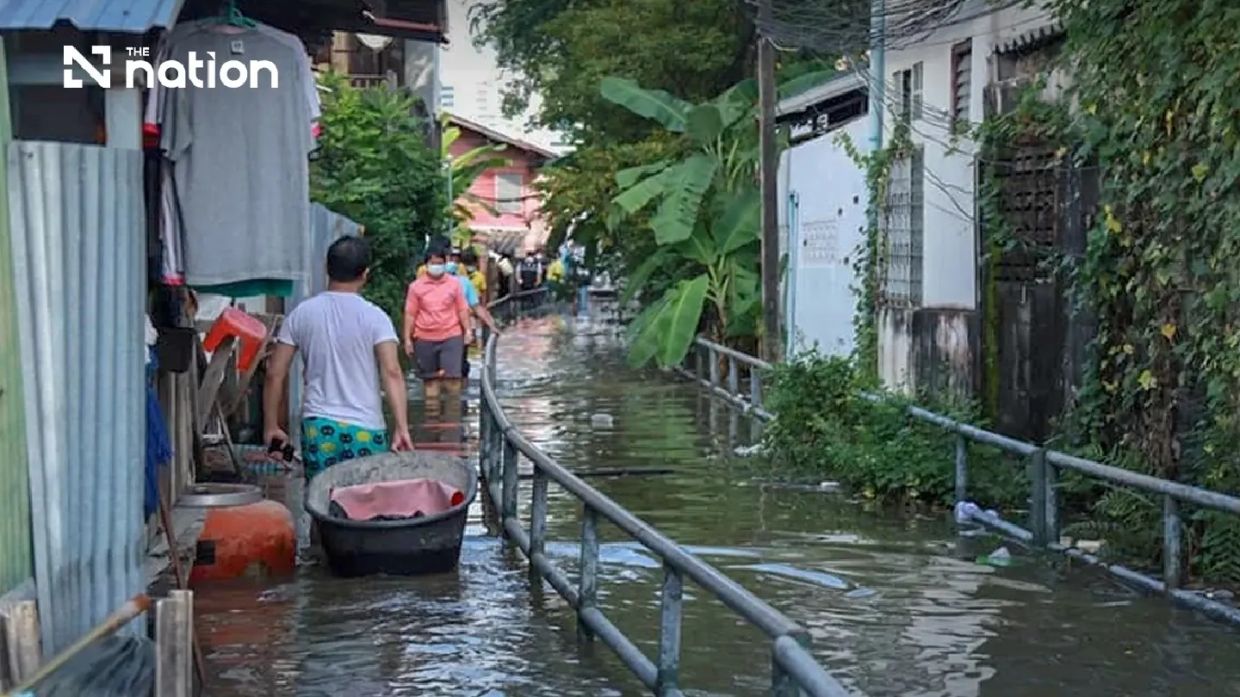
Thailand's Department of Disaster Prevention and Mitigation has issued a precautionary alert across seven jurisdictions in the central region as weather patterns converge to produce elevated sea levels that could threaten riverside communities and low-lying areas. The warning, announced on Saturday and taking effect from Monday, encompasses six provinces surrounding the capital—Pathum Thani, Nonthaburi, Nakhon Pathom, Samut Sakhon, Samut Songkhram and Samut Prakan—along with Bangkok itself. The alert period extends through the following Sunday, covering a week when tidal activity in the Gulf of Thailand is expected to push water levels higher than normal into the country's vital river network.
Director-General Theerapat Kachamat explained that the department had been tracking data from the Royal Thai Navy's Hydrographic Department, which monitors sea conditions and water movements along Thailand's coastlines. The navy had observed that water levels near Phra Chulachomklao Fort and the surrounding Chao Phraya River estuary would experience pronounced elevation particularly during evening hours, with the most critical window falling between 6pm and 10pm each day through the alert period. This timing proves significant for residents and businesses, as evening hours often coincide with reduced visibility and limited capacity for emergency response if flooding occurs.
The phenomenon poses genuine risks to communities that lack permanent flood defences or sit outside established barriers. Officials anticipate water will surge over riverbank boundaries and raise levels throughout the interconnected system of rivers and canals that crisscross central Thailand. Areas of particular vulnerability include those designated outside official flood protection zones, as well as informal settlements and business districts that have developed along waterways without substantial structural safeguards. The threat extends beyond residential neighbourhoods to encompass floating restaurants, waterfront commercial operations and construction sites where riverbank reinforcement projects are underway—all activities that depend on stable water conditions.
Distinct geographic zones have been identified as requiring heightened vigilance. In Pathum Thani, the Mueang and Sam Khok districts face elevated risk, while Nonthaburi's vulnerable areas span Mueang Nonthaburi, Pak Kret and Bang Kruai. Nakhon Pathom's Bang Len, Nakhon Chai Si and Sam Phran districts require close monitoring, and notably, all districts of Samut Songkhram—the smallest and lowest-lying of Thailand's provinces, located at the Maeklong River delta—have been flagged for concern. In Samut Prakan, the Mueang, Phra Samut Chedi, Phra Pradaeng and Bang Bo districts represent concentration points where urbanisation has intensified vulnerability to tidal flooding.
The Central Disaster Prevention and Mitigation Command has directed provincial authorities to undertake active public communication campaigns. Officials must disseminate precise information about anticipated high-tide timings to business proprietors, residents in at-risk zones and all relevant government agencies. The instruction reflects recognition that awareness and preparation—particularly knowing when danger peaks—can significantly reduce casualties and economic losses. Private enterprises operating on waterways have been specifically urged to implement additional precautions, securing equipment and adjusting operations to accommodate temporarily elevated water levels.
Thailand's experience with recurring tidal flooding and riverine inundation has spurred development of multiple reporting and response channels for the public. The THAI DISASTER ALERT mobile application provides real-time notifications and warnings tailored to users' locations, enabling residents to receive targeted information relevant to their specific areas. For those experiencing flooding or requiring immediate assistance, the DDPM has established a LINE social-messaging service accessible through the ID @1784DDPM, supplemented by a dedicated hotline numbered 1784 that operates round-the-clock. This multi-channel approach reflects lessons learned from previous flooding events, ensuring that emergency coordination can function effectively even when conventional communication infrastructure becomes compromised.
The alert underscores the ongoing challenge that Thailand faces in managing the interface between its critical waterway infrastructure and expanding population concentrations. The Chao Phraya River system, which supplies water for agriculture, industry and urban consumption across the central region, naturally experiences tidal fluctuations driven by lunar cycles and seasonal monsoon patterns. However, decades of riverbank development, dam construction upstream and subsidence in certain areas have altered historical hydrological patterns, sometimes intensifying flood impacts in locations that previously experienced only minor inconvenience. Recent infrastructure modifications and climate-related changes to rainfall and storm surge patterns have compounded these complexities.
For Malaysian readers and broader Southeast Asian observers, the Thai situation reflects challenges common across the region's major river deltas. Like Malaysia's own experience with annual monsoon flooding in Peninsular regions, Thailand must balance economic development pressures against the imperative to protect vulnerable populations from natural hazards. The Chao Phraya estuary and delta zone, similar to Malaysia's Klang Valley and Muar regions, concentrates significant urban and industrial populations in areas where water management requires continuous attention and coordination across multiple agencies and jurisdictions. The Thai government's proactive alert system represents an approach that other regional countries have adopted or are developing—using technology and pre-positioned information to enhance public safety before crisis situations materialise.
The extended seven-day alert window provides affected communities and authorities with adequate time to implement protective measures, secure critical equipment and prepare emergency response capabilities. Floating businesses can adjust mooring arrangements, temporary flood barriers can be positioned in vulnerable locations, and evacuation plans can be reviewed and communicated to residents in highest-risk areas. The coordinated nature of the alert, spanning multiple provinces and the capital, demonstrates institutional capacity for cross-jurisdictional disaster planning—a requirement that grows increasingly important as urbanisation expands beyond traditional city boundaries.

