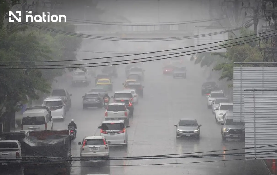
The Thai Meteorological Department (TMD) has escalated its alert status regarding severe weather threatening Thailand's northern and northeastern regions, issuing its ninth weather advisory on Wednesday as a monsoon system moves into position. Between now and Friday, August 21, residents across upper Thailand should prepare for intense precipitation that meteorologists warn could quickly transform into dangerous flash floods and rapid surface runoff, particularly in vulnerable terrain and drainage basins. The department's escalating series of warnings reflects growing concern about the combination of meteorological factors converging over the region, creating conditions ripe for localized but potentially catastrophic flooding events.
The adverse weather stems from two colliding atmospheric systems: a monsoon trough advancing across the North and upper Northeast, compounded by an unusually vigorous southwest monsoon circulation over the Andaman Sea and Gulf regions. This atmospheric alignment has created an engine for moisture convergence and persistent cloud formation. The interaction between these weather patterns has already begun intensifying ocean conditions, generating progressively hazardous sea states that pose immediate threats to maritime traffic throughout Thailand's western and eastern coastal waters. For communities in foothill areas, river valleys, and naturally low-lying zones, the concern centers on how successive rounds of rainfall will accumulate, potentially overwhelming local drainage infrastructure and triggering dangerous flooding phenomena.
Meteorological modeling indicates that northern Thailand will experience near-continuous thunderstorm activity, with an estimated 80 percent coverage across the region from Wednesday evening through Thursday. Seven provinces face particular peril due to forecasted very heavy rain accumulation: Mae Hong Son, Lampang, Nan, Phrae, Uttaradit, Phitsanulok and Phetchabun. Simultaneously, eight additional northern provinces—Chiang Mai, Chiang Rai, Phayao, Lamphun, Sukhothai, Tak, Kamphaeng Phet and Phichit—will experience heavy rainfall capable of exacerbating flood conditions. Temperature variations during this period will remain relatively modest, ranging from overnight lows of 22 to 27 degrees Celsius to daytime highs between 28 and 34 degrees. Light to moderate southwest winds between 10 and 20 kilometres per hour will provide only marginal relief from the moisture-laden environment.
Northeastern Thailand faces similarly concerning conditions, with approximately 80 percent of that vast region expecting thunderstorms. The Thai Meteorological Department has highlighted especially dangerous rainfall prospects in 12 provinces across the Northeast, where heavy precipitation will likely develop: Nong Bua Lamphu, Chaiyaphum, Khon Kaen, Maha Sarakham, Roi Et, Yasothon, Amnat Charoen, Nakhon Ratchasima, Buriram, Surin, Si Sa Ket and Ubon Ratchathani. Beyond these areas, eight additional northeastern provinces may receive very heavy rain, including parts of Loei, Nong Khai, Bueng Kan, Udon Thani, Sakon Nakhon, Nakhon Phanom, Kalasin and Mukdahan. Temperature ranges in the Northeast will span from 22 to 25 degrees Celsius overnight to 27 to 32 degrees during daylight hours, with comparable wind patterns to the North.
Central Thailand and the eastern region will also experience significant precipitation, though perhaps with slightly lower intensity than areas further north. The Central region is forecast to see thunderstorms covering approximately 60 percent of its territory, with heavy rain possible in major provinces including Nakhon Sawan, Phra Nakhon Si Ayutthaya, Lop Buri, Saraburi, Kanchanaburi and Ratchaburi. The East will experience even broader storm coverage at roughly 70 percent of the region, with heavy rainfall expected in Nakhon Nayok, Prachin Buri, Sa Kaeo, Chachoengsao and Chanthaburi. Notably, Trat province faces potential very heavy rain. Bangkok and its surrounding provinces will experience isolated thunderstorms and heavy rain across approximately 60 percent of the metropolitan area, with overnight temperatures between 25 and 27 degrees and daytime peaks reaching 33 to 35 degrees Celsius.
The maritime implications of this weather system are proving equally severe. Wave heights across the upper Andaman Sea and upper Gulf of Thailand are expected to reach two to three metres during normal conditions, with waves exceeding three metres during thunderstorm passages. The lower Andaman Sea anticipates slightly more moderate conditions, with baseline waves near two metres rising above that threshold in stormy areas. Along Thailand's eastern coast, waves will reach two to three metres, potentially exceeding those heights during intense convective activity. The Thai Meteorological Department has advised all vessels operating in these waters to proceed with maximum caution, while specifically directing small boats operating in the upper Andaman Sea and upper Gulf to remain ashore until Friday to avoid catastrophic encounters with heavy seas.
Fortunately, wave conditions along the southern coast, from Phetchaburi southward through Surat Thani and Nakhon Si Thammarat, remain relatively less severe, with wave heights generally remaining between one and two metres, though they will still exceed two metres during thunderstorm development. The eastern coast of the South, primarily affecting Phetchaburi, Prachuap Khiri Khan, Chumphon and Surat Thani, faces only 40 percent thunderstorm coverage, making this the least threatened region under current forecasts. However, even these areas should remain vigilant, as meteorological conditions can shift rapidly and unexpectedly.
Public safety authorities have emphasized that residents should treat this as a serious weather event requiring active preparation rather than passive concern. Communities located in historically flood-prone areas should give particular attention to evacuation route planning and real-time monitoring of official warnings. Those living near waterways, in foothill regions, or in naturally low-lying terrain should ensure their households have emergency supplies and communication devices. Motorists are being specifically advised to avoid roads with documented histories of repeated flooding, particularly routes traversing low-lying zones where temporary water accumulation can develop with startling rapidity during heavy precipitation events. The three-day forecast window provides adequate time for property owners to secure valuables and for families to organize contingency plans.
These weather patterns reflect broader seasonal dynamics in Southeast Asia's monsoon system, a phenomenon that typically brings extended periods of heavy precipitation to mainland Thailand during the summer and autumn months. The convergence of multiple atmospheric features—monsoon troughs, strengthened trade winds, and warm ocean surface temperatures—creates the meteorological conditions necessary for sustained rainfall. For Malaysian readers, this situation echoes similar challenges that peninsular Malaysia faces during its own monsoon seasons, particularly the northeast monsoon affecting the east coast from November through March. The Thai experience provides relevant lessons for how neighboring countries prepare infrastructure and emergency response systems to cope with monsoon-driven flooding events that respects no political boundaries in the broader Southeast Asian region.

