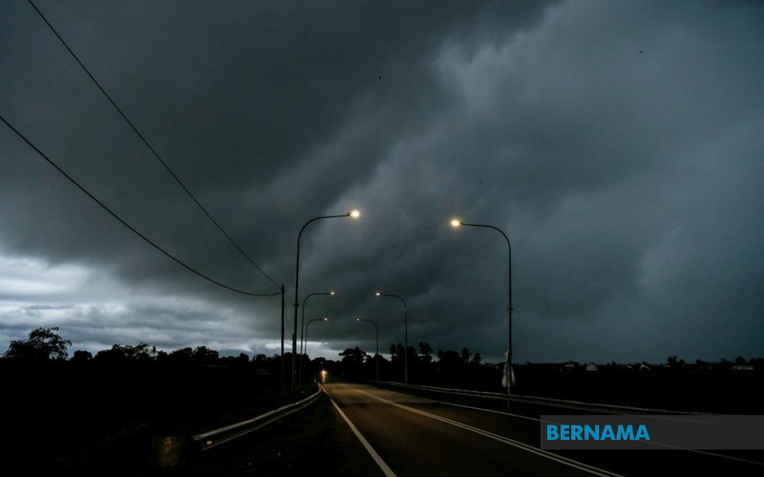
A widespread thunderstorm alert has been activated across Malaysia, with the Malaysian Meteorological Department cautioning residents in nine states, the capital and the federal territory of Putrajaya to prepare for severe weather conditions until 6 pm. The forecasted threat encompasses heavy rainfall and strong winds that could affect daily activities and pose risks to vulnerable communities in low-lying areas and those dependent on outdoor operations.
The warning extends across the southern peninsula, covering specific districts in Johor, Negeri Sembilan, Perak, Kelantan, Terengganu, Pahang and Selangor. In Johor, residents should brace for unstable atmospheric conditions, while the warning for Negeri Sembilan indicates potential flooding risks in certain municipalities. Perak residents in areas including Hulu Perak, Kuala Kangsar, Kinta, Kampar, Hilir Perak, Batang Padang and Muallim have been put on high alert, reflecting the department's assessment of significant storm potential across this drought-prone state.
The East Coast states of Kelantan, Terengganu and Pahang face particularly heightened risk. In Kelantan, the affected districts include Tumpat, Pasir Mas, Jeli, Tanah Merah, Kuala Krai and Gua Musang, suggesting the entire state experiences concurrent weather instability. Terengganu's coastal and interior districts—Setiu, Kuala Nerus, Kuala Terengganu, Marang, Dungun and Kemaman—are all under warning, indicating a coast-to-interior system likely driven by monsoon interactions. Pahang's expansive warning zone encompasses the highlands around Cameron, lowland areas such as Bentong and Temerloh, and coastal Pekan, reflecting the state's diverse geography and susceptibility to different storm mechanisms.
Selangor residents, particularly those in areas surrounding Kuala Lumpur, should exercise caution as the metropolitan region itself faces thunderstorm conditions. Affected Selangor districts include the northern Sabak Bernam and Kuala Selangor, the interior Hulu Selangor and Gombak areas, central Petaling and Hulu Langat, and the southern Sepang district. This means commuters and businesses across the Klang Valley corridor should anticipate potential traffic disruptions and power supply interruptions. Kuala Lumpur's own inclusion in the alert suggests the Petaling Jaya and Kuala Lumpur City Centre areas may experience intense downpours affecting urban drainage systems.
East Malaysian states are equally affected, with Sarawak experiencing warnings across diverse districts from coastal Kuching and Sarikei through central Sibu, Mukah and Kapit to the northern Bintulu and Miri divisions, extending to border regions in Limbang. The extensive coverage across Sarawak indicates a significant weather system influencing the broader nation. Sabah's situation mirrors this pattern, with interior areas including Sipitang, Tenom, Beaufort, Nabawan, Keningau and Tambunan facing severe conditions alongside west coast districts of Papar, Penampang, Kota Kinabalu, Tuaran and Ranau, plus the eastern Sandakan division zones of Tongod, Telupid, Beluran and Sandakan itself.
The geographical spread of this warning—from Johor through to Limbang and across both peninsular and East Malaysian terrain—suggests a consolidated atmospheric disturbance rather than isolated local phenomena. Such extensive simultaneous warnings typically emerge from significant pressure system transitions, monsoon interactions or tropical weather developments that meteorologists consider serious enough to warrant public notice. The persistence until 6 pm indicates the department expects the system to maintain strength through the afternoon peak hours, when thunderstorms tend to intensify.
For Malaysian residents and businesses, such warnings carry practical implications beyond mere inconvenience. Heavy rain can trigger flash flooding in urban areas with inadequate drainage, particularly in Klang Valley suburbs and East Coast municipalities with histories of waterlogging. Strong winds accompanying thunderstorms pose structural risks to construction sites, temporary structures and vegetation, while electrical hazards from lightning strikes constitute genuine safety concerns. Drivers face reduced visibility and slippery road conditions, potentially disrupting the critical afternoon-to-evening commute period when traffic volumes peak.
The meteorological department's issuance of this alert represents a precautionary public safety measure designed to allow residents, businesses and emergency services to prepare appropriately. Those in affected areas are advised to secure loose outdoor items, avoid unnecessary travel and remain indoors during the most intense periods. Motorists should reduce speed and exercise heightened caution, while those in flood-prone zones should be prepared to relocate if necessary. Power supply disruptions remain a genuine possibility, making it prudent for households to have alternative lighting and communication devices readily available.
This warning exemplifies the increasing complexity of Malaysian weather patterns in a warming climate, where severe thunderstorms have become more frequent and intense across multiple regions simultaneously. The affected states represent Malaysia's economic heartland—from the industrial Klang Valley to the Johor manufacturing belt and the resource-rich East Malaysian territories—meaning such weather events carry significant economic ramifications beyond immediate public safety considerations. Businesses dependent on reliable power and transportation networks should implement contingency plans accordingly.

