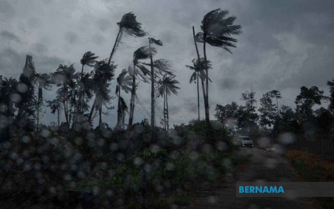
The Malaysian Meteorological Department issued a severe weather alert early this morning, warning of thunderstorms, heavy rain and strong winds sweeping across multiple regions of Peninsular Malaysia and Sarawak. The advisory was released at 8.35 am and remains in effect until 1pm, giving residents and commuters a narrow window to prepare for potentially hazardous conditions across a geographically diverse swathe of the country.
In the northern reaches of Peninsular Malaysia, the entire states of Perlis and the island of Langkawi face the brunt of the expected deluge, alongside the Kedah districts of Kubang Pasu and Kota Setar. This region, which borders Thailand and experiences seasonal monsoon patterns, is particularly vulnerable to rapid weather system development during certain times of the year. The inclusion of Langkawi, a major tourist destination, underscores the potential disruption to visitor activities and maritime operations around the island.
Moving down the eastern seaboard, the warning extends to several Pahang municipalities centred around its population heartland. Kuantan, the state capital and primary commercial hub, faces disruption alongside the river towns of Pekan and Jerantut, which lie in low-lying areas prone to flooding during intense rainfall events. The concentration of warnings in Pahang reflects the state's geographical exposure to weather systems approaching from the South China Sea and the seasonal precipitation patterns that characterise the east coast.
The Klang Valley and its surroundings in Selangor remain under alert, with Sepang and Kuala Langat designated as priority areas. Given Selangor's status as Malaysia's most densely populated state and its role as the industrial and commercial nerve centre of the nation, disruptions here carry outsized implications for the broader economy and the daily routines of millions of residents. Flash flooding in low-lying industrial zones and residential areas has historically caused significant disruption during similar weather events.
In Negeri Sembilan, a cluster of districts spanning from Port Dickson on the coast to inland municipalities including Seremban, Rembau, Kuala Pilah and Tampin have been flagged. This pattern suggests a weather system with sufficient breadth to affect both coastal and inland terrain across the state. Port Dickson, in particular, may experience maritime hazards that could disrupt fishing and port operations.
The southern state of Johor sees two municipalities included in the alert: Tangkak and Muar, both significant commercial and agricultural centres. The relatively limited geographic scope of the warning within Johor suggests the weather system maintains a defined track rather than affecting the entire southern region uniformly.
On the island of Borneo, MetMalaysia has extended the alert to Sarawak's division spanning from the coastal areas through the river systems inland. Mukah, Selangau, Sibu, Sarikei, Maradong, Bintulu, Kapit, Bukit Mabong and Subis in the Miri division have all been included. This coverage encompasses Sarawak's major population centres and economically significant regions, suggesting the weather system affecting the peninsula may have a counterpart affecting the island state simultaneously.
The Malaysian Meteorological Department classifies this as a short-term weather warning valid for a maximum period of six hours for each individual advisory. This classification reflects the relative localisation and brevity of the expected weather event, though it does not necessarily diminish the intensity of conditions during the affected timeframe. Short-term warnings typically indicate rapidly developing systems or transient phenomena that meteorologists can forecast with reasonable confidence over a limited temporal horizon.
For residents and commuters across the affected areas, the practical implications are substantial. Thunderstorms accompanied by heavy rainfall can transform urban drainage systems and create flash flood conditions, particularly in historically flood-prone zones. Commuters utilising roads and public transportation should anticipate delays and exercise heightened caution, especially on elevated highways where strong wind gusts pose handling challenges for vehicles. The afternoon timing of the alert, expiring at 1pm, suggests the worst conditions may impact late morning and midday hours, coinciding with peak commercial and business activity across most affected regions.
Businesses operating in affected zones should implement contingency protocols, particularly those reliant on logistics or time-sensitive operations. Construction sites, outdoor events and recreational facilities may require temporary closure or suspension of operations during the peak of the weather system's passage. Maritime activities, including fishing and port operations in coastal areas, should observe heightened safety protocols given the combination of heavy rain and strong winds that typically accompany severe thunderstorm activity.
The geographic distribution of this alert illustrates how weather systems in Malaysia can simultaneously affect regions hundreds of kilometres apart, underscoring the interconnected nature of atmospheric patterns across the peninsula and larger Southeast Asian region. The inclusion of both coastal and inland areas suggests a substantial weather system rather than isolated cell activity, which typically produces more localized and concentrated impacts.
Residents are encouraged to monitor official weather updates from MetMalaysia as conditions develop, particularly those in flood-prone areas who should remain vigilant regarding water levels and drainage conditions. The alert's validity until 1pm provides a clear reference point, though individuals should exercise personal judgment regarding local conditions which may persist beyond the formal advisory period, particularly in areas affected by secondary flooding or debris accumulation.

